The drone surveillance system presents a technological solution to real-life and practical problems. There are plenty of solutions available across different business sectors, however, the most natural way to counter a solution is, to begin with, an overview of the problem. A change in our perspective can highlight the aggravated problems and the source of a potential crash. The Aerial Mapping Drone is designed to do just that. Here at FENGLIAN, the expert UAV designing and building engineers offer the right insight towards this kind of development. The technology and investment opportunity features a simple concept represented practically with drone technology.

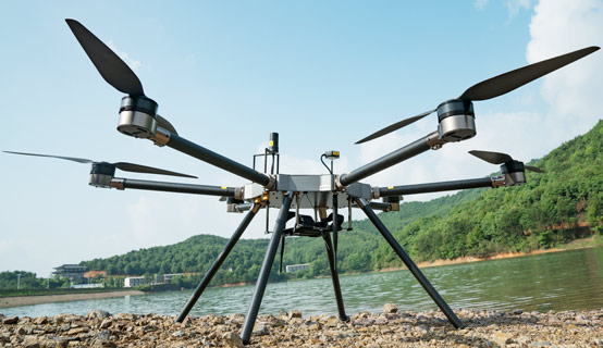
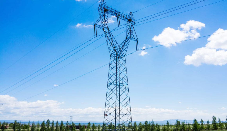
Aerial mapping broadly refers to the task of planning roads and residences of a particular location with an overhead view. A mapping process requires the understanding of road dimensions, infrastructural elements, and the population count in that particular area. The aerial mapping drones present the change in the perspective for surveyors and urban development officers by offering bird’s eye view. In the initial stage of solving landscaping, problems is to find a higher perspective. The aerial drone is built to fly accurate heights set by the operators. It also has the facility of changing the perspective that can be viewed or shared by multiple users with the live streaming option.
Modern technology has made its way to change the technique of dealing with the world and the people. UAV technology doesn’t always have to be in the interest of science and mathematics; technology can also stand for human development. In other words, a gradual improvement of human actions and tasks introduces a new style to function with. The operating process for most of the models of aerial drones includes location, visuals, and data collection. These three elements dictate the result of the flight because the footage is extracted as a resource or proof. The information obtained from the color-coded scans and high-definition images are factual and accurate to lead the Drone & UAV Mapping Platform. The drone technology includes attachment of a brilliant camera lens to be able to capture the highs and lows of the ground while being practically wireless.
The first pilotless aircraft was designed by the US Army towards the end of World War 1. The military drone technology people witness at this point is blueprinted from the radio-controlled aircraft from the 1930s. In this period, the United States and England worked independently to lay the foundation of military drones. Chronologically, the modern-day drone does have similarities with the first drone. After extensive development and trial and error, modern-day drones are designed to be lightweight, connected for communication, and silent. Drone technology is a wonder on its own because unlike airplanes, the operating pilot is still on the ground level.
The change in the perspective introduced by drones has simplified land-based or physical problems faced by agriculturalists, environmentalists, and surveyors. Changes in urban development and city planning have become a wider and better scope in terms of a work profile. In the changing trends of modern times, it’s important to be involved in a field of work that carries the objective of leaving a positive impact on society. There are several benefits to working for the greater good. There are plenty of ways to serve the cities without having to endure physical and mental exhaustion. The step by step process of land evaluation and monitoring is a steady and tedious process. Fieldwork does require certain characteristics which include high observatories levels and detailed evaluation of land heights and depths. The perspective captured by the drone has proved to help the team of surveyors and city planners to refer to a reliable source of information. Additionally, the drone perspective can be accessed by multiple people from multiple locations to maintain the discussion on the same page.
The drone was initially invented by Nikola Tesla in the late 1800s as the first functioning UAV prototype. Once the Americans and English were seeded with the idea, the trial and error phase for military drones took place. Initially, the pilot-free aircraft was controlled and communicated with the radio networks. The remote-controlled communication allowed messages to be conveyed and the flying operation managed from one location. UAV technology provides the right flexibility, movement, and documentation of a higher perspective. Pilotless aircraft presents an opportunity for multiple industries and businesses with a new performing technique.
In layman terms, a similar concept and technology are applied to automated children’s toys including remote-controlled cars and planes. The basics of radio network communication are embedded in appreciated children’s toys. However, drone technology solves intense and high demanding problems faced by physical laborers. UAV technology promotes the right support to the industrial, commercial, and agricultural assignments.
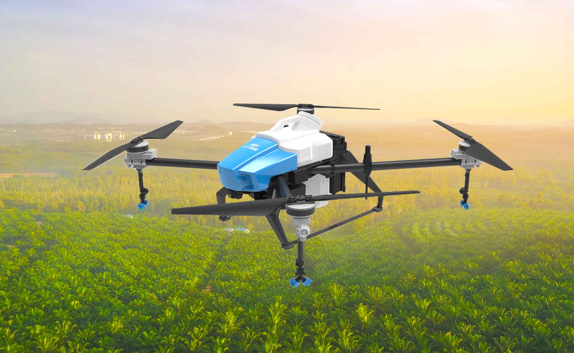
A Drone Farming concept has saved them time and physical effort of laborers, farmers and agriculturalists alike. It is easier to monitor the progress of the crops every season with the help of a lightweight and silent unmanned flying vehicle. The camera lenses fitted on the drone capture the most accurate photographs that indicate temperament, depth, height, and movement. Farming with a drone has facilitated the overall seeding, planting, watering, and harvesting process on the field. Growing produce is like clockwork, the growth of the crops are highly dependent on the timely watering and sunlight hours. Producing raw food material in cooperation with nature’s stubborn weather cycle means receiving the rough end of the bargain. Therefore, to guide the necessary and demanding agricultural sector towards success; Unmanned Aerial Vehicles need to embedded into the step by step process.
These flying devices assist farming throughout every step of the way. An aerial agricultural drone can be used for an even distribution of seeds across the land or it can be used for an even distribution of pesticides. Drone technology and engineering fit right into almost every business, production, manufacturing, and human development plan. UAVs are featured with the essential security traits to make it a universal device of development.
 Established in 2010, FZ international is specialized in the design, development, manufacture and sale of fashion